Verifying Compliance of Project Documentation with the Rules on Methodology and the Decree on Conditions and Limitations for Siting and Activities
The purpose of the task is the implementation of provisions in accordance with the Rules on Methodology to Define Flood Risk Areas and Erosion Areas Connected to Floods and Classification of Plots into Risk Classes (Official Gazette of the RS, No. 60/07) and the Decree on Conditions and Limitations for Constructions and Activities in Flood Risk Areas (Official Gazette of the RS, No. 89/08).
While reviewing the hydrological and hydraulic expert bases necessary to examine the possibility of carrying out activities in flood areas (Kolman G., IWRS Activity Report for 2014), which must comply with the Rules and the Decree, a uniform system for managing the reviewed and confirmed hydrological-hydraulic studies has been established for the needs of the Ministry of the Environment and Spatial Planning, the Slovenian Environment Agency and the Institute for Water of the Republic of Slovenia.
In 2014, the established and updated uniform records of reviewed documentation served as a source of data in some of the other tasks from the IWRS Programme for 2014, i.e. in updating the flow records (IWRS Programme for 2014, Task I/2/4: Update of the Records and the Data Layer of Q10, Q100 and Q500 Flows from HH Studies, the IWRS Archive and the Results of Analyses of the Slovenian Environment Agency), in updating the integrated map of flood risks and the map of classes of flood risks (IWRS Programme for 2014, Task I/2/6: Update of the Integrated Map of Flood Risks and the Integrated Map of Classes of Flood Risks for Publication in the Environmental Atlas and the Making of an Integrated Map of Water Depth Classes at Q100) and in updating the flood warning map (IWRS Programme for 2014, Task I/2/7: Update of the 2007 Flood Warning Map).
All hydrological-hydraulic studies that have been reviewed by the Slovenian Environment Agency or by the IWRS and then confirmed as positive or rejected as negative have been entered in the record table. The reviewed project documentation was used in procedures for getting permits or permission to carry out activities in flood areas within the framework of spatial planning when drafting spatial plans (national and municipal spatial plans, detailed municipal spatial plans and in issuing building permits).
Keywords
OTHER NATIONAL REFERENCES
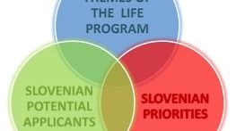
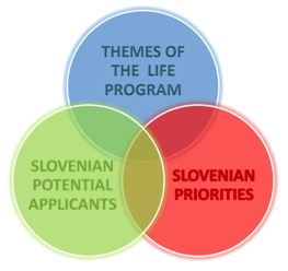
Expert bases for determining the priorities of the Republic of Slovenia in the field of environment and efficient use of resources and identification of the themes that are most suitable for co-financing from the LIFE program
In the framework of the project task, we prepared guidelines on the thematic priorities from the Multi-annual LIFE work program for the period 2014–2017 in the priority area Environment and efficient use of resources, and Environmental management and information for Lot 1: water, including the marine environment. The thematic priorities...
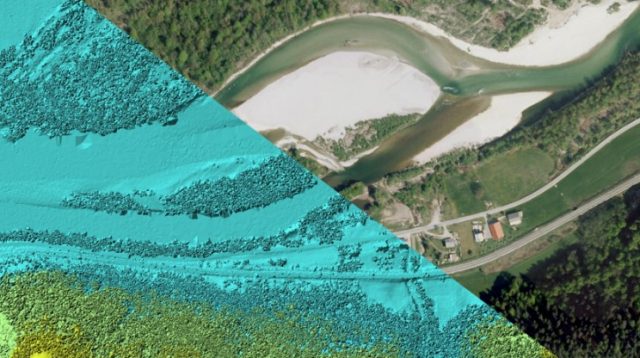
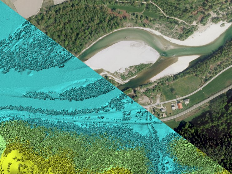
Remote sensing of large river hydromorphological characteristics and impact assessment on biotic communities
The project’s aim is to identify and compare impacts of different stressors (hydromorphological alterations, pollution, land use), acting on different spatial scales (reach, segment, catchment), on benthic macroinvertebrate and fish communities in Slovenian large rivers, as well as to analyse the comparability between field survey and remote sensing based hydromorphological...
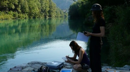
Monitoring of the river ecosystem on water licence area on the river Soča
In this project our task is to monitor the impact of hydropower plant operation on river Soča ecological status/potential, specifically on biological quality elements, hydrological, and physico-chemical quality elements according to the current legislation.