Hydromorphology – the Study of the Hydromorphological Characteristics of Surface Water and the Changes in the Hydromorphological Processes and Characteristics Resulting from Various Disturbances of the Aquatic Environment

With the increasing demand for water for irrigation, power generation, breeding of aquatic organisms and activities affecting water and waterside land due to settlement, development of transport infrastructure and agricultural land use, man has caused numerous changes to the natural hydromorphological characteristics. Many barriers and dams were built, interrupting the characteristic longitudinal flow continuity, more often than not making the corridors narrower and depriving the rivers of their natural channel patterns. Variegated riverbeds have in many cases been replaced with rectangular and trapezoidal shapes, while their banks and beds have been reinforced using rigid materials.

Updating the Integrated Maps of Floods

In order to implement the Decree on Conditions and Limitations for Constructions and Activities on Flood Risk Areas (Official Gazette of the RS, No. 89/08) concerning the preparation of national spatial plans of state priority, records of HH studies have been established for which both the IWRS and the Slovenian Environment Agency have issued opinions confirming their compliance with the methodology rules and a data layer at the cadastral municipality level has been developed (published in the Environmental Atlas).

Preliminary Identification of Key Inundation Areas of High Waters in the Area of Slovenia

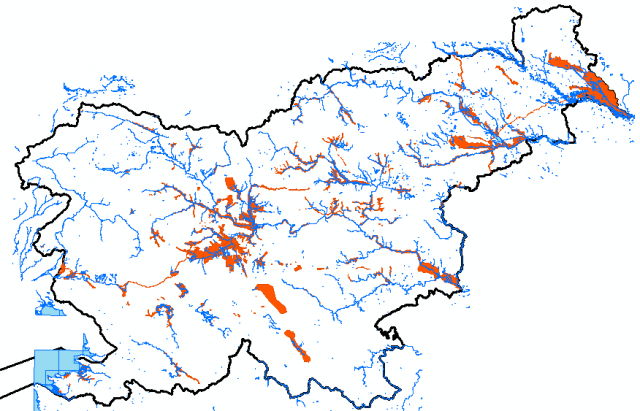
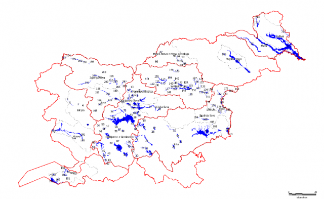
Significant flood hazard areas are defined as part of flooding areas where floodwater can spill and be retained without significant damage, potentially reducing any damaging effects downstream. The Floods Directive prescribes taking into account the areas where floodwater could be retained (natural floodplains). The designation of areas is based on both relevant implementing regulations, i.e. the Decree on Drawing Up a Water Management Plan and the Rules on Mapping Methodology.

UPDATING THE CONCEPT OF CONSTRUCTION OF HYDROPOWER PLANTS ON THE MURA IN WMP II

In order to determine public interest as stipulated by Article 4.7 of the Water Framework Directive on the possibility of deviating from the objective of the existing good status or the good ecological potential of bodies of water due to the construction of hydro-electric power plants, we prepared expert groundwork for assessment methodologies that use uniform criteria.

International Operation and Integration

By reason of the transboundary nature of the marine environment, Member States need to cooperate to ensure the coordinated development of marine strategies for each marine region or subregion. Member States therefore strive to ensure that assessment methodologies are consistent across the marine region or subregion and that transboundary impacts and transboundary features are taken into account.

Use and Spatial Planning of Coastal Waters

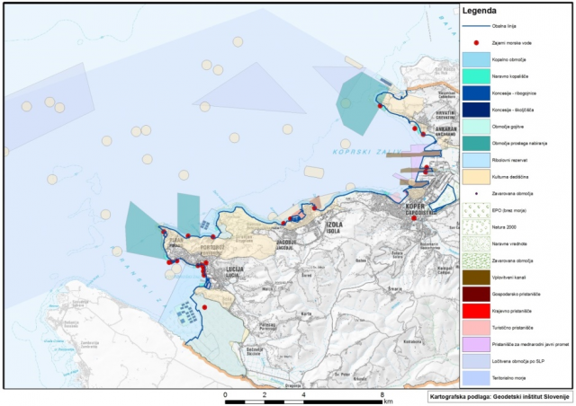
The presence of the sea defines a number of specific activities, for example industry, tourism, port activities, mariculture, fishing, etc. that are directly tied to the sea and to the use of the sea or are a related activity. By using the sea, these activities directly impact each other, competing and imposing various legal regimes on one another, which can lead to conflicts regarding sea use in relation to living environment protection objectives, natural ecosystems and landscapes and to granted water rights and decreased economic performance of some of the activities.

Marine Litter (Descriptor 10)

Marine litter includes all solid waste of anthropogenic (human) origin that enters the marine environment in any way. If not removed, the litter remains where it was left. The Slovenian marine environment and coast contain litter of all types and origins. Most of it is from plastic materials originating from land (settlement, tourism, industry) and marine activities (fishing, mariculture, sea transport).

Predominant Pressures and Impacts

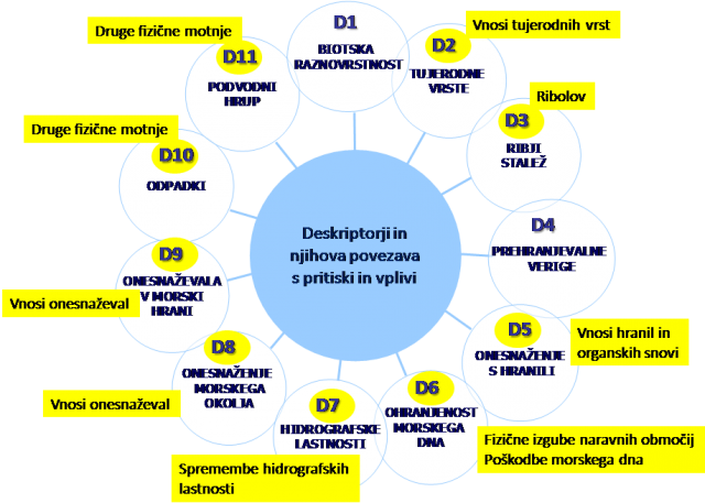
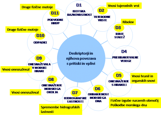
The report on predominant pressures and impacts describes human activity in the coastal area and at sea and lists the direct and indirect pressures and impacts caused by these activities. Various activities can cause physical losses in habitats, including physical damage to the seabed, environmental pressures with noise and waste, contamination by hazardous substances and nutrients and biological pressures. Pictured below is the connection between the descriptors and the elements discussed in the chapter on pressures and impacts.

Essential Characteristics of Marine Waters

The analysis of the essential environmental features and characteristics of the relevant waters is based on the indicative lists of elements covering the physical and chemical features, the habitat types, the biological features and the hydromorphology. The first analysis describes the initial state of the marine environment and serves as a proposal for selecting the characteristics that best describe good marine environment status. In agreement with other Adriatic and Mediterranean countries, this proposal will be used to select the characteristics for which regular monitoring will be set up.