Classification of Flood Risk Areas and Determination of Areas of Significant Impact of Floods in Slovenia

One of the major objectives of the preliminary assessment of flood risk is to identify the areas of significant impact of floods at the national level so that detailed maps of flood risks and flood threats along with flood risk management plans can be created. Within the framework of the preliminary assessment and the analysis of future floods and their potential damage, we have developed a tool that improves the transparency of decision-making with respect to the locations of flood risk areas that need to be prioritised when making flood risk management plans and providing resources for implementing the planned flood protection measures.
The determination was based on the concept of priority classification of actual and potential flood risk areas. Based on five basic classification maps of flood risk areas and a sixth, common combination map and on the basis of the chosen criteria of importance, eight variants of proposals for areas of significant impact of floods were developed. The proposal for public discussion was created using uniform criteria of the first 40% of the common risk index of the combination map (K) and the first 20% of the common index of the basic classification maps (O) showing the health of people (ZL), the environment (OK), cultural heritage (KD), economic activities (GD) and sensitive installations (OB). After the public discussion and after 50 proposals, comments and initiatives were considered, the final data layer was created on a scale of 1:50,000 containing 61 areas of significant impact of floods in the Republic of Slovenia and the basic statistics on what is at risk in these areas.
In 61 areas of significant impact of floods (50 km2 in total), 130,000 inhabitants, 23,000 buildings, 540 cultural monuments, 17,000 business entities, 600km of public infrastructure and 400 sensitive installations are potentially at risk. The indicated areas of significant impact of floods show that implementing construction works in the amount of approx. €600 million would reduce the country’s flood risk by half, whereby it should be noted that in the past 25 years, floods have caused damage of about €75 million per year.
Link to Additional Content:
- Đurović, B. 2012. Determination and Classification of Flood Risk Areas in Slovenia, Summary of the Work Method and the Results, IWRS, Ljubljana. Available at: http://www.mko.gov.si/fileadmin/mko.gov.si/pageuploads/podrocja/voda/metodologija_dolocanja_obmocij.pdf
- Report on Determining Areas of Significant Impact of Floods in the Republic of Slovenia and on Monitoring Flood Risk Management Activities in Areas of Significant Impact of Floods (Ministry of Agriculture and the Environment, 2013). Available at: www.mko.gov.si/fileadmin/mko.gov.si/pageuploads/podrocja/voda/porocilo_OPVP.pdf
Project Staff
Darko Anzeljc
Related Content:
- Amendment and Supplementation of the Flood Warning Map. Annual Report on Work on Task I/2/2.1, Task Leader: Darko Anzeljc. Institute for Water of the Republic of Slovenia, November 2012. Client: Ministry of the Environment and Spatial Planning, Programme of Tasks of IWRS for 2012; Available at: http://evode.arso.gov.si/direktive/FD_tabela.htm
- Preliminary Assessment of Flood Risk. Annual Report on Work on Task I/3/1, Task Leader: Darko Anzeljc. Institute for Water of the Republic of Slovenia, December 2011. Client: Ministry of the Environment and Spatial Planning, Programme of Tasks of IWRS for 2011.
- Preparation of Maps of Flood Risks and Maps of Classes of Flood Risks for 7 Areas of Significant Impact of Floods in the Republic of Slovenia. Annual Report on Work on Task I/2/11, Task Leader: Tina Mazi. Institute for Water of the Republic of Slovenia, September 2014. Client: Ministry of the Environment and Spatial Planning, Programme of Tasks of IWRS for 2014 (the task has been underway since 2013); Available at: http://evode.arso.gov.si/direktive/FD_tabela.htm
- Preparation of Maps of Flood Threats for the Areas of Significant Impact of Floods in the Republic of Slovenia (2013–2014). Annual Report on Work on Task I/2/2, Task Leader: Blažo Đurović. Institute for Water of the Republic of Slovenia, December 2013, December 2014. Client: Ministry of the Environment and Spatial Planning, Programme of Tasks of IWRS for 2013 and 2014.
- Update of the Integrated map of flood risks and the Integrated Map of Classes of Flood Risks for Publication in the Environmental Atlas (60 New HH Studies) and Design of the Integrated Map of Water Depths at Q100. Annual Report on Work on Task I/2/6, Task Leader: Mladen Ajdič. Institute for Water of the Republic of Slovenia, December 2014. Client: Ministry of the Environment and Spatial Planning, Programme of Tasks of IWRS for 2014 (the task has been underway since 2012); Available at: http://evode.arso.gov.si/direktive/FD_tabela.htm
- Preparation of the Economic Content of Flood Risk Management Plans. Annual Report on Work on Task I/2/3, Task Leader: Špela Petelin. Institute for Water of the Republic of Slovenia, December 2014. Client: Ministry of the Environment and Spatial Planning, Programme of Tasks of IWRS for 2014 (the task has been underway since 2013); Available at: http://evode.arso.gov.si/direktive/FD_tabela.htm.
Keywords
OTHER NATIONAL REFERENCES
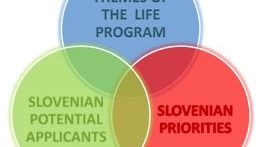
Expert bases for determining the priorities of the Republic of Slovenia in the field of environment and efficient use of resources and identification of the themes that are most suitable for co-financing from the LIFE program
In the framework of the project task, we prepared guidelines on the thematic priorities from the Multi-annual LIFE work program for the period 2014–2017 in the priority area Environment and efficient use of resources, and Environmental management and information for Lot 1: water, including the marine environment. The thematic priorities...
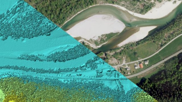
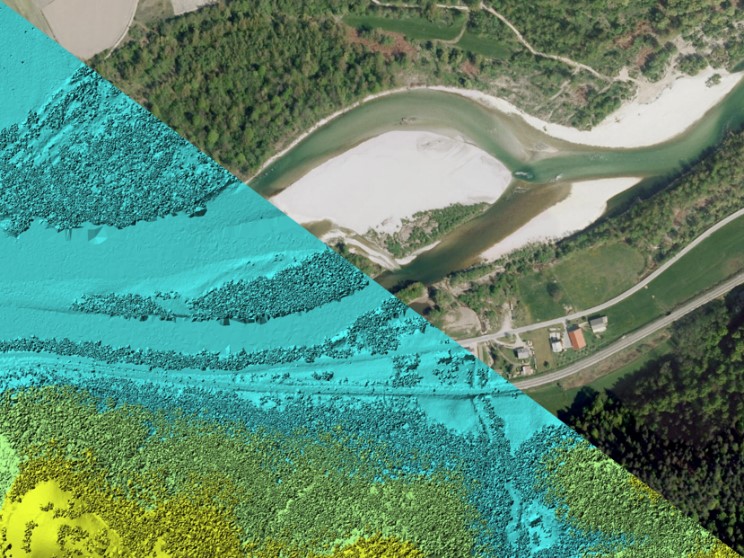
Remote sensing of large river hydromorphological characteristics and impact assessment on biotic communities
The project’s aim is to identify and compare impacts of different stressors (hydromorphological alterations, pollution, land use), acting on different spatial scales (reach, segment, catchment), on benthic macroinvertebrate and fish communities in Slovenian large rivers, as well as to analyse the comparability between field survey and remote sensing based hydromorphological...
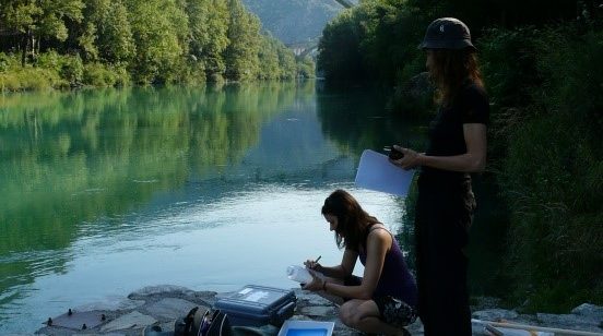
Monitoring of the river ecosystem on water licence area on the river Soča
In this project our task is to monitor the impact of hydropower plant operation on river Soča ecological status/potential, specifically on biological quality elements, hydrological, and physico-chemical quality elements according to the current legislation.