Hydrological Analysis of the Flood Event on the Drava, 5 November 2012 Final Report 8 May 2013 (incl. Appendix)
Amendment and supplementation of the flood warning map

On Sunday, 4 November 2012, Koroška and Slovenia were swept by rain that intensified in the early morning on Monday, 5 November, particularly in the Karavanks. Before the event, the Drava River basin in Koroška was soaked from previous rainfall, and the headwaters of the Drava River and its tributaries were under a heavy snow cover. The rainfall was accompanied by a fairly strong warming effect, which further strengthened the increased runoff with melting snow. This weather situation resulted in high rates of flow of the Drava River and its tributaries.
Relevant Area
The Drava River basin at the section of the Amlach–Borl gauging stations.
Baselines for Analysis
1. acquiring and applying available data,
2. understanding the precipitation and the hydrological situation as best as possible in order to actively follow the presentation of the Austrian report at the extraordinary session of the Slovenian-Austrian Commission for the Drava River and consequently to ask for additional explanations (to improve the report) and to submit the initiative to improve forecasting and response in high water situations.
Data Used
1. Reports provided by the Slovenian Environment Agency
2. Data provided by the Slovenian Environment Agency in a digital format (for the Drava River basin) that supports analysis
3. Acquired from websites
4. Publications
5. Data acquired within the operation of the working group for continued detailed study of the flood event on the Drava River basin in Austria and Slovenia in November 2012
Hydrological Analysis
The following data and baselines were taken into account to present the event on the Drava River using runoff hydrographs:
p1. Hydrographs of flows at the sections of gauging stations and hydro-electric power plants;
p2. Hourly data was also used;
p3. If a peak rate of flow was not recorded on the hour, its value was recorded on the nearest beginning of the hour;
p4. Estimates of the travel (propagation) of the flood wave were provided (accurate to one hour) based on the section length, location, wave travel velocity estimated on the basis of experience from similar events and the values used in the hydrological model (source 16);
p5. The possibility of the wave changing its shape was not considered in the travel of the flood wave;
p6. In order to determine the runoff hydrograph for hinterlands without observation, we chose a recorded runoff hydrograph from an area deemed to be the most similar to the area without observation in question. The recorded hydrograph was linearly transformed into a hydrograph of the area without observation using a factor that was determined based on the ratio of hinterlands and the ratio of average precipitation between the measured area and the area without observation (Fm/Fn * Pm/Pn);
p7. The calculation was carried out in tabular form (using Microsoft Excel) based on the input hydrograph from the Amlach gauging station;
p8. Meanings of individual marks: KW, HE … hydro-electric power plant
p9. The results are shown in the form of runoff hydrographs at the sections of hydro-electric power plants, gauging stations and areas without observation;
p10. The marks used after the name of the section mean:
“_d” … calculated “actual” hydrograph
“_n” … calculated “natural” hydrograph
no mark … the hydrograph has been recorded
area without observation … the name of the hydrograph is composed of the correlation factor for the name of the correlation hydrograph and the area number
Conclusions
Manoeuvring activities at the hydro-electric power plants on the Drava River have caused the shape and peak of the runoff hydrograph to change. The changes are already visible at the Rožek-Šentjakob v Rožu HPP. However, the changes due to operation are the most pronounced at the Annabrücke HPP (KW ANNABRÜCKE) and to an even greater extent at the Kazaze HPP (KW EDLING).
The difference of the increased Drava River rate of flow due to the operation of the HPP chain at the national border section is between 650 and 750 m3/s.
The shape of the Drava River hydrographs (the actual and the “natural”) at the national border section is confirmed by the balanced estimate of the discharge volume (26 million m3) and of the retention volume (26 million m3) of the accumulations on the HPP chain shown in Figure 25. The impact of “discharging” the accumulations is evident on 5 November 2012 between 3:00 and 17:00, while the impact of “filling” is twofold and is evident between 17:00 (5/11) and 8:00 (6/11) and between 20:00 (6/11) and 10:00 (7/11).
At the national border section, the estimated actual peak rate of flow is 2670 m3/s with a return period of about 100 years; the expected “natural” peak rate of flow is 1980 m3/s and would have a return period of less than 20 years.
At the Vuzenica HPP section (below the inflow of the Meža River into the Drava River), the estimated actual peak rate of flow is 3060 m3/s with a return period of about 400 years; the expected “natural” peak rate of flow is 2360 m3/s and would have a return period of about 40 years.
Keywords
OTHER NATIONAL REFERENCES

Expert bases for determining the priorities of the Republic of Slovenia in the field of environment and efficient use of resources and identification of the themes that are most suitable for co-financing from the LIFE program
In the framework of the project task, we prepared guidelines on the thematic priorities from the Multi-annual LIFE work program for the period 2014–2017 in the priority area Environment and efficient use of resources, and Environmental management and information for Lot 1: water, including the marine environment. The thematic priorities...
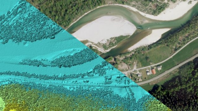
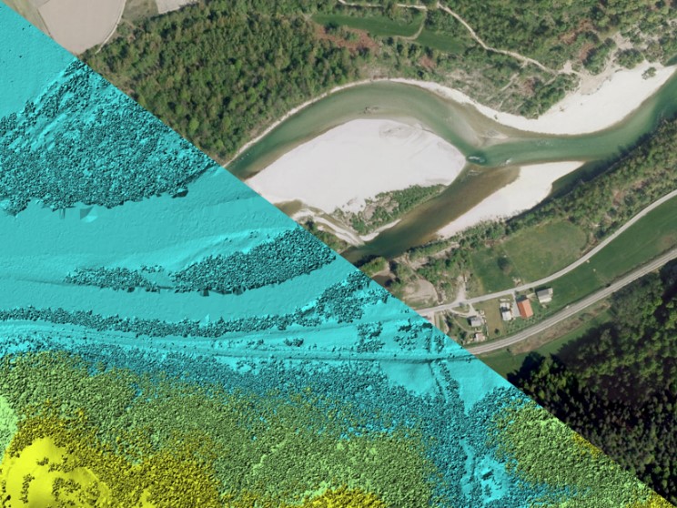
Remote sensing of large river hydromorphological characteristics and impact assessment on biotic communities
The project’s aim is to identify and compare impacts of different stressors (hydromorphological alterations, pollution, land use), acting on different spatial scales (reach, segment, catchment), on benthic macroinvertebrate and fish communities in Slovenian large rivers, as well as to analyse the comparability between field survey and remote sensing based hydromorphological...
Monitoring of the river ecosystem on water licence area on the river Soča
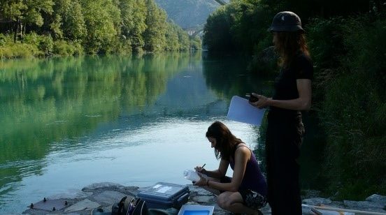
In this project our task is to monitor the impact of hydropower plant operation on river Soča ecological status/potential, specifically on biological quality elements, hydrological, and physico-chemical quality elements according to the current legislation.