IMPLEMENTING THE FLOOD DIRECTIVE (2007/60/EC)
Preliminary assessment of flood risk

The document deals with topics based on the requirements of Directive 2007/60/EC. It presents the sources of the used data, methods and results while considering the baselines of transparency and homogeneity for the purpose of identifying potential flood risk areas and classifying flood risk areas by importance (at the national level) according to the level of risk. This tool can be used in the decision-making process.
Purpose, Content and Objective
The main purpose was to classify flood risk areas by importance (at the national level) using a methodological approach based on data on the danger potential (type, floodplain, probability, intensity and duration of flood events) and the damage potential (magnitude, value, vulnerability and exposure of people, the environment, cultural heritage and economic activities).
In addition to determining the size of the danger potential, it was also necessary to determine the size of the damage potential in the flooding areas and classify it into size classes with the help of appropriate indicators. The indicators and the classes are determined using available data on: locations and the number of inhabitants permanently or occasionally residing in the territory of Slovenia, areas and facilities that could cause large-scale environmental pollution according to environmental protection regulations, cultural heritage protected under cultural heritage protection regulation and areas relevant to the implementation of economic and non-economic activities.
Article 7 of the Decree on Establishment of Flood Risk Management Plans (OG RS, No. 7/2010) sets out the preparation method and Article 8 the content of the preliminary assessment of flood risk.
In Article 9, the Ministry defines the areas it has identified as areas of significant impact of floods.
In light of this, the objective of our task is to assess the size of the flood damage potential in Slovenia using the most objective method, criteria and conditions. It makes sense to assess the damage potential of the elements of space at the level of the whole national territory as this would ensure to a certain degree the sustainability of the risk analysis results, considering that the flooding areas on the flood warning map are updated pursuant to Article 7(2) of the Rules on Methodology to Define Flood Risk Areas and Erosion Areas Connected to Floods and Classification of Plots into Risk Classes (OG RS, No. 60/2007).
Some of the Topics Covered in the Report
DIRECTIVE 2007/60/EC (FLOOD DIRECTIVE)
1. Water infrastructure and Directive 2007/60/EC
2. Implementation of the Flood Directive in Slovenia
3. Transposition of the Flood Directive provisions into Slovenian law
4. Preparation of expert bases for decision-making
5. Identification of water infrastructure objectives
METHODOLOGICAL APPROACH
DANGER POTENTIAL
DAMAGE POTENTIAL
CLASSIFICATION OF FLOOD RISK AREAS ACCORDING TO RISK LEVEL
REQUIREMENTS OF ARTICLE 4 OF THE FLOOD DIRECTIVE
1. Description of past and major floods
REQUIREMENTS OF ARTICLE 5 OF THE FLOOD DIRECTIVE
1. Proposal 1: areas of significant impact of floods (according to water regulations)
2. Proposal 2: areas of significant impact of floods (IWRS proposal)
3. Proposal 3: areas of significant impact of floods (IWRS proposal)
Conclusion
Upon analysing the damage from each event, it is evident that the share of the overall direct damage to the water infrastructure has been increasing since the 1990 event (when it was approx. 19%), reaching 25% in 1998, 38% in 2007, 72% in 2009 and 62% in 2010.
Furthermore, we can conclude that increasing water infrastructure maintenance would lead not only to it having less damage but also the infrastructure would be able to perform its function, resulting in decreased damage in the other damage segments.
On the basis of the above conclusion and the determination of the areas of significant impact of floods, we propose increasing capital costs, giving priority to the water infrastructure that affects areas of significant impact of floods.
Keywords
OTHER NATIONAL REFERENCES

Expert bases for determining the priorities of the Republic of Slovenia in the field of environment and efficient use of resources and identification of the themes that are most suitable for co-financing from the LIFE program
In the framework of the project task, we prepared guidelines on the thematic priorities from the Multi-annual LIFE work program for the period 2014–2017 in the priority area Environment and efficient use of resources, and Environmental management and information for Lot 1: water, including the marine environment. The thematic priorities...
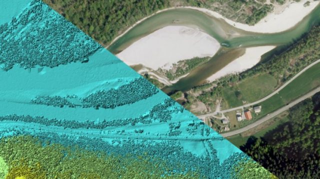
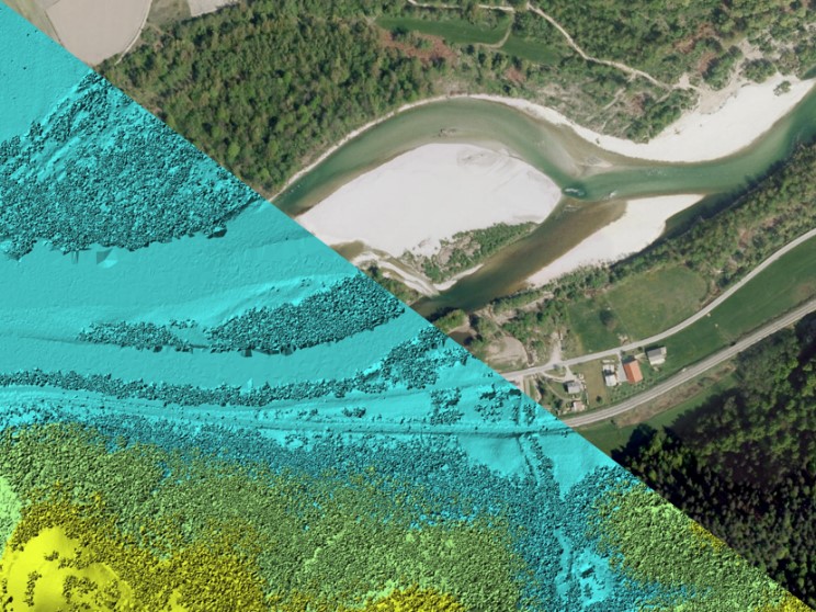
Remote sensing of large river hydromorphological characteristics and impact assessment on biotic communities
The project’s aim is to identify and compare impacts of different stressors (hydromorphological alterations, pollution, land use), acting on different spatial scales (reach, segment, catchment), on benthic macroinvertebrate and fish communities in Slovenian large rivers, as well as to analyse the comparability between field survey and remote sensing based hydromorphological...
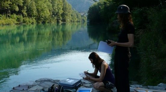
Monitoring of the river ecosystem on water licence area on the river Soča
In this project our task is to monitor the impact of hydropower plant operation on river Soča ecological status/potential, specifically on biological quality elements, hydrological, and physico-chemical quality elements according to the current legislation.