Assessment of Damage Caused by Flooding of the Drava River on 5–6 November 2012 Final Report 18 September 2013

Based on the acquired available data on damage caused by flooding for the flood event on the Drava River on 5 November 2012, it was necessary to assess the difference between the damage that was actually caused (i.e. was reported and recorded) and the damage that would have been caused if the Drava River had an approx. 700 m3/s lower rate of flow, the so-called “natural” rate of flow. We used the data on damage provided by the AJDA system (ACPDR) and on economic damage (from the Ministry of Economic Development and Technology’s website).
The primary aim of the damage assessment approach chosen in the study is to determine the magnitude of the difference in the damage, which will assist the competent authorities in deciding on further steps.
Data Used in the Assessment of Damage
1. Damage recorded in the AJDA system
2. Economic damage
3. Intervention costs
4. Extent of flooded areas of the Drava River
Baselines and Assumptions Used in the Assessment of Damage
1. The division of the entire Drava River flood area in question (73 km2) into 33 sections according to municipal borders and the locations of the Drava River HPP barrier sections;
2. The recorded amounts of damage (AJDA, Ministry of Economic Development and Technology, intervention costs) are realistic;
3. Analysis of 7 smaller flood areas (54 km2), where more data was available, is representative of the entire Drava River flood area in question;
4. Flooding could have caused damage that was not covered by this analysis, which means that the difference in the damage could be higher;
5. The Q100 floodplain (VGB_2013) is greater than it would have been at the “natural” Q40 rate of flow (IWRS_2013);
6. Damage within the Q100 floodplain is greater or equal to the “natural” rate of flow (Q40);
7. The Q10 floodplain is lower than it would have been at the “natural” rate of flow (Q40);
8. Damage within the Q10 floodplain is lower than at the “natural” rate of flow (Q40);
9. Water depth at Q40 is 0.5m lower than at Q100;
10. For the flood area at the “natural” rate of flow (Q40), we took into account the flood area envelope curve at the Q10 rate of flow + the G2 depth class (0.5m to 1.5m at Q100) + the G3 depth class (depths greater than 1.5m at Q100);
11. Damage at a location would have been lower if the depth and force of the floodwater would have been lower. The “possible” reduction factors according to the type of damage form were taken into account, i.e. 20% lower damage on Forms 3 and 4 and 40% lower damage on Forms 5 and 501;
12. Since the site of economic damage is not precisely defined, it has been corrected using the calculated reduction factor for all types of damage determined on the AJDA form;
13. Since the site of intervention costs is not defined, they have been corrected using the calculated reduction factor for all types of damage and costs;
14. Due to the lower extent of flooding in “natural” floods, a 20% reduction in intervention costs was taken into account.
Conclusion
The total damage from the flooding of the Drava River was estimated at around €105 million.
In light of the present data and the analyses performed, we estimate that the additional flow rate of the Drava River (approx. 700 m3/s) has caused between 35 and 61 million euros worth of damage. At the natural rate of flow, the damage would have been 34–58% lower.
Flooding could have caused damage that was not covered by this study, which means that the difference in the damage could be higher.
For this study, we assumed that the recorded amounts of damage were realistic.
Keywords
OTHER NATIONAL REFERENCES

Expert bases for determining the priorities of the Republic of Slovenia in the field of environment and efficient use of resources and identification of the themes that are most suitable for co-financing from the LIFE program
In the framework of the project task, we prepared guidelines on the thematic priorities from the Multi-annual LIFE work program for the period 2014–2017 in the priority area Environment and efficient use of resources, and Environmental management and information for Lot 1: water, including the marine environment. The thematic priorities...
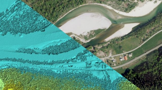
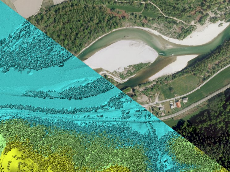
Remote sensing of large river hydromorphological characteristics and impact assessment on biotic communities
The project’s aim is to identify and compare impacts of different stressors (hydromorphological alterations, pollution, land use), acting on different spatial scales (reach, segment, catchment), on benthic macroinvertebrate and fish communities in Slovenian large rivers, as well as to analyse the comparability between field survey and remote sensing based hydromorphological...
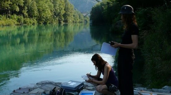
Monitoring of the river ecosystem on water licence area on the river Soča
In this project our task is to monitor the impact of hydropower plant operation on river Soča ecological status/potential, specifically on biological quality elements, hydrological, and physico-chemical quality elements according to the current legislation.